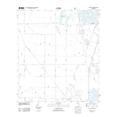
2012 Map of Farles Lake
USGS Topo · Published 2012About this map
Farles Prairie and its surrounding wetlands anchor this study of the Ocala National Forest interior as it appeared in the early 21st century. The landscape is defined by its characteristic Florida karst topography, where scattered basins like Farles Lake and the Sink Hole Ponds mark a terrain of fluctuating water levels. Small, named watering points such as Greens Waterhole and Yearling Pond suggest the traditional use of these lands for timber and livestock before their preservation as national forest.
Find a feature on this map
29 named features on this map. Tap any name to fly to it.
Don’t see what you’re looking for? This feature index may not catch every label — zoom into the map to look around manually.
Map Details
Editions of this 2012 Farles Lake Map
This is the sole edition of this map. No revisions or reprints were ever made.
Other maps of this area

1954 · Daytona Beach
USGS Topo · 1:250,000

1955 · Orlando
USGS Topo · 1:250,000

1957 · Orlando
USGS Topo · 1:250,000

1958 · Orlando
USGS Topo · 1:250,000

1958 · Daytona Beach
USGS Topo · 1:250,000

1962 · Orlando
USGS Topo · 1:250,000

1964 · Daytona Beach
USGS Topo · 1:250,000

1965 · Umatilla
USGS Topo · 1:24,000
1965 · Paisley
USGS Topo · 1:24,000
1966 · Emeralda Island
USGS Topo · 1:24,000