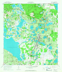
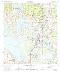
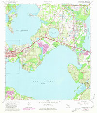
1965 Map of Umatilla
USGS Topo · Published 1967About this map
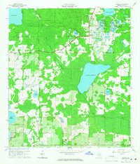
Umatilla serves as the central hub of this Lake County landscape during the mid-1960s, defined by its complex network of interconnected basins and citrus-growing terrain. The Atlantic Coast Line railroad dictates the local geography, running north-south through settlements like Altoona and Dona Vista while passing by the Municipal Airport. The northern portion of the map is dominated by the southern reaches of the Ocala National Forest, which gives way to a dense cluster of water bodies including Ella Lake, Crescent Lake, and the expansive Lake Yale. Local history is preserved in several significant sites, from the Glendale Cem and Lakeside Memory Gardens to the Emmanuel Ch. The presence of a Sandpit and Claypit near the rail lines points to the active resource extraction supporting the region's development during this era of Florida's growth.
Find a feature on this map
62 named features on this map. Tap any name to fly to it.
Don’t see what you’re looking for? This feature index may not catch every label — zoom into the map to look around manually.
Map Details
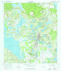
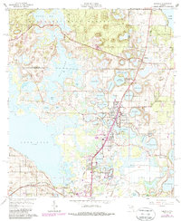
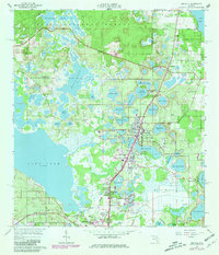
Editions of this 1965 Umatilla Map
5 editions found
Other maps of this area

1954 · Daytona Beach
USGS Topo · 1:250,000

1955 · Orlando
USGS Topo · 1:250,000

1957 · Orlando
USGS Topo · 1:250,000

1958 · Orlando
USGS Topo · 1:250,000

1958 · Daytona Beach
USGS Topo · 1:250,000

1960 · Sorrento
USGS Topo · 1:24,000

1962 · Orlando
USGS Topo · 1:250,000

1964 · Daytona Beach
USGS Topo · 1:250,000
1965 · Leesburg East
USGS Topo · 1:24,000
1965 · Paisley
USGS Topo · 1:24,000