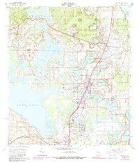
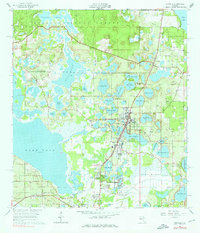
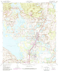
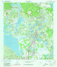
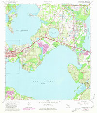
1965 Map of Umatilla
USGS Topo · Published 1989About this map
Ocala National Forest defines the northern edge of this Lake County landscape, where the sandy ridges of central Florida meet a dense concentration of freshwater basins. The settlement of Umatilla serves as a central hub, situated between Lake Umatilla and the extensive Ella Lake. The presence of numerous named water bodies like Lake Owen, North Twin Lake, and Lake Pearl illustrates the complex karst topography of the region, where sinkhole lakes are separated by subtle elevation changes.
Find a feature on this map
62 named features on this map. Tap any name to fly to it.
Don’t see what you’re looking for? This feature index may not catch every label — zoom into the map to look around manually.
Map Details
Editions of this 1965 Umatilla Map
5 editions found
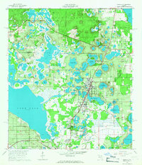
Other maps of this area

1954 · Daytona Beach
USGS Topo · 1:250,000

1955 · Orlando
USGS Topo · 1:250,000

1957 · Orlando
USGS Topo · 1:250,000

1958 · Orlando
USGS Topo · 1:250,000

1958 · Daytona Beach
USGS Topo · 1:250,000

1960 · Sorrento
USGS Topo · 1:24,000

1962 · Orlando
USGS Topo · 1:250,000

1964 · Daytona Beach
USGS Topo · 1:250,000
1965 · Leesburg East
USGS Topo · 1:24,000
1965 · Umatilla
USGS Topo · 1:24,000