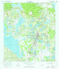
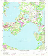
1965 Map of Umatilla
USGS Topo · Published 1976About this map
Lake Yale and the southern reaches of the Ocala National Forest define this mid-1960s landscape, where the citrus-rich terrain of Lake County is punctuated by dozens of named water bodies. The Atlantic Coast Line railroad serves as the primary spine for development, linking the settlements of Umatilla, Altoona, and Dona Vista. The map reveals a community structured around its water, from the residential clusters at Silver Beach Heights to the numerous smaller basins like Lake Mary and Lake Enola that border the town centers.
Find a feature on this map
62 named features on this map. Tap any name to fly to it.
Don’t see what you’re looking for? This feature index may not catch every label — zoom into the map to look around manually.
Map Details
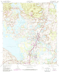
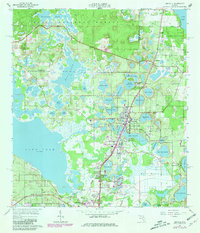
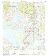
Editions of this 1965 Umatilla Map
5 editions found
Other maps of this area

1954 · Daytona Beach
USGS Topo · 1:250,000

1955 · Orlando
USGS Topo · 1:250,000

1957 · Orlando
USGS Topo · 1:250,000

1958 · Orlando
USGS Topo · 1:250,000

1958 · Daytona Beach
USGS Topo · 1:250,000

1960 · Sorrento
USGS Topo · 1:24,000

1962 · Orlando
USGS Topo · 1:250,000

1964 · Daytona Beach
USGS Topo · 1:250,000
1965 · Leesburg East
USGS Topo · 1:24,000
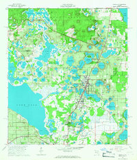
1965 · Umatilla
USGS Topo · 1:24,000