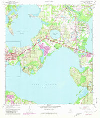
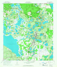
1965 Map of Umatilla
USGS Topo · Published 1987About this map
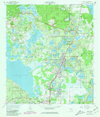
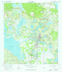
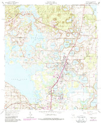
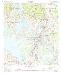
Ocala National Forest forms a verdant backdrop to the north as citrus groves and residential developments expand through the lake-studded landscape of central Florida. The town of Umatilla serves as a central hub, connected to Altoona and Eustis by the Seaboard Coast Line railroad. This 1965 survey, updated in the late 1970s, captures the region's agricultural and transportation transition, showing the density of residential growth in Dona Vista and Eustis Meadows.
Find a feature on this map
62 named features on this map. Tap any name to fly to it.
Don’t see what you’re looking for? This feature index may not catch every label — zoom into the map to look around manually.
Map Details
Editions of this 1965 Umatilla Map
5 editions found
Other maps of this area

1954 · Daytona Beach
USGS Topo · 1:250,000

1955 · Orlando
USGS Topo · 1:250,000

1957 · Orlando
USGS Topo · 1:250,000

1958 · Orlando
USGS Topo · 1:250,000

1958 · Daytona Beach
USGS Topo · 1:250,000

1960 · Sorrento
USGS Topo · 1:24,000

1962 · Orlando
USGS Topo · 1:250,000

1964 · Daytona Beach
USGS Topo · 1:250,000
1965 · Leesburg East
USGS Topo · 1:24,000
1965 · Umatilla
USGS Topo · 1:24,000