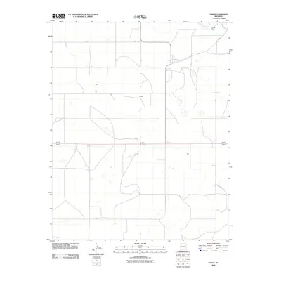
2010 Map of Farley
USGS Topo · Published 2010About this map
The settlement of Farley serves as the primary hub of this high plains landscape in northeastern New Mexico, where a grid of county roads connects a series of small residential and agricultural clusters. The region's history is traced through named locales such as Bada, Fleming, and Olson, which reflect the sparse but persistent settlement pattern of Colfax County. In the north, Muller Dam represents a critical water management feature in an area defined by wide intervals between resources. Transport through the territory is anchored by State Road 193 and a network of arterial paths including County Rd A001 and County Hwy C-002. The map also identifies secondary points like McCarty, Minter, Dacy, and Beard, documenting the names of individual families or small communities that have shaped the rural character of the high desert plateau.
Find a feature on this map
27 named features on this map. Tap any name to fly to it.
Don’t see what you’re looking for? This feature index may not catch every label — zoom into the map to look around manually.
Map Details
Editions of this 2010 Farley Map
This is the sole edition of this map. No revisions or reprints were ever made.
Other maps of this area

1954 · Raton
USGS Topo · 1:250,000

1954 · Dalhart
USGS Topo · 1:250,000

1958 · Raton
USGS Topo · 1:250,000

1958 · Dalhart
USGS Topo · 1:250,000

1962 · Dalhart
USGS Topo · 1:250,000

1973 · Gladstone NW
USGS Topo · 1:24,000

1974 · Point Of Rocks Mesa
USGS Topo · 1:24,000

1974 · Farley
USGS Topo · 1:24,000
1974 · Lawrence Arroyo
USGS Topo · 1:24,000

1974 · Spear Hills
USGS Topo · 1:24,000