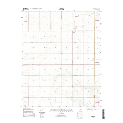
2013 Map of Farley
USGS Topo · Published 2013About this map
Farley stands as a central point in this high-plains landscape of northeastern New Mexico, where the Colfax and Union county lines meet. The terrain is defined by the winding paths of Sand Arroyo and Wilson Arroyo, which cut through the open country. This 2013 survey illustrates a sparsely populated region marked by small clusters and named locales such as Bada, Fleming, McCarty, and Minter. The road network, including Redlich Rd and Bluebell Rd, connects these remote outposts, while Lanier Lake provides a distinct water feature in an otherwise arid environment. The map details the transition from flat tablelands to more varied elevations near Dacy and Beard, offering a clear view of the ranching and rural infrastructure that persists in this corner of the state.
Find a feature on this map
19 named features on this map. Tap any name to fly to it.
Don’t see what you’re looking for? This feature index may not catch every label — zoom into the map to look around manually.
Map Details
Editions of this 2013 Farley Map
This is the sole edition of this map. No revisions or reprints were ever made.
Other maps of this area

1954 · Raton
USGS Topo · 1:250,000

1954 · Dalhart
USGS Topo · 1:250,000

1958 · Raton
USGS Topo · 1:250,000

1958 · Dalhart
USGS Topo · 1:250,000

1962 · Dalhart
USGS Topo · 1:250,000

1973 · Gladstone NW
USGS Topo · 1:24,000

1974 · Point Of Rocks Mesa
USGS Topo · 1:24,000

1974 · Farley
USGS Topo · 1:24,000
1974 · Lawrence Arroyo
USGS Topo · 1:24,000

1974 · Spear Hills
USGS Topo · 1:24,000