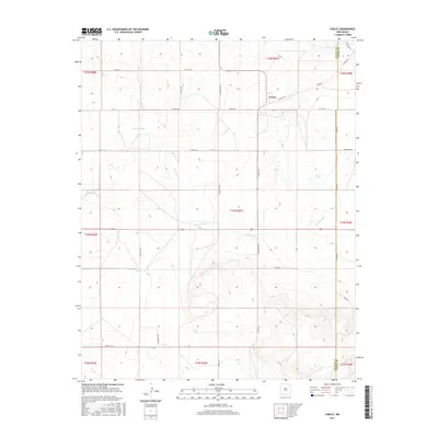
2017 Map of Farley
USGS Topo · Published 2017About this map
The settlement of Farley sits near the intersection of Farley Rd and State Road 193, serving as a quiet focal point in this high plains landscape of northeastern New Mexico. This 2017 survey details a region defined by its wide, open drainage patterns and a strictly organized network of section-line roads. The local hydrology is dominated by ephemeral waterways like Sand Arroyo and Wilson Arroyo, which wind across the terrain toward the east. The presence of Lanier Lake provides a rare perennial water feature in an otherwise arid environment primarily utilized for large-scale ranching. Along the eastern edge, the Colfax Co Union Co line marks the political boundary where the plains continue into the neighboring county. A dense grid of named rural routes, such as Sofia Rd, Rock Lake Rd, and Hackamore Rd, illustrates the enduring structure of the Public Land Survey System in this part of the state.
Find a feature on this map
36 named features on this map. Tap any name to fly to it.
Don’t see what you’re looking for? This feature index may not catch every label — zoom into the map to look around manually.
Map Details
Editions of this 2017 Farley Map
This is the sole edition of this map. No revisions or reprints were ever made.
Other maps of this area

1954 · Raton
USGS Topo · 1:250,000

1954 · Dalhart
USGS Topo · 1:250,000

1958 · Raton
USGS Topo · 1:250,000

1958 · Dalhart
USGS Topo · 1:250,000

1962 · Dalhart
USGS Topo · 1:250,000

1973 · Gladstone NW
USGS Topo · 1:24,000

1974 · Point Of Rocks Mesa
USGS Topo · 1:24,000

1974 · Farley
USGS Topo · 1:24,000
1974 · Lawrence Arroyo
USGS Topo · 1:24,000

1974 · Spear Hills
USGS Topo · 1:24,000