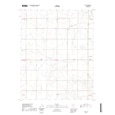
2023 Map of Farley
USGS Topo · Published 2023About this map
Farley sits at the intersection of a sprawling rural road network in this section of Colfax County. The landscape is defined by the ephemeral drainage patterns of Sand Arroyo and Wilson Arroyo, which weave through the high plains terrain. Land use is largely agricultural, evidenced by the gridded township and range lines and the presence of named local routes like Sofia Rd, Farley Rd, and McCarty Rd.
Find a feature on this map
39 named features on this map. Tap any name to fly to it.
Don’t see what you’re looking for? This feature index may not catch every label — zoom into the map to look around manually.
Map Details
Editions of this 2023 Farley Map
This is the sole edition of this map. No revisions or reprints were ever made.
Other maps of this area

1954 · Raton
USGS Topo · 1:250,000

1954 · Dalhart
USGS Topo · 1:250,000

1958 · Raton
USGS Topo · 1:250,000

1958 · Dalhart
USGS Topo · 1:250,000

1962 · Dalhart
USGS Topo · 1:250,000

1973 · Gladstone NW
USGS Topo · 1:24,000

1974 · Point Of Rocks Mesa
USGS Topo · 1:24,000

1974 · Farley
USGS Topo · 1:24,000
1974 · Lawrence Arroyo
USGS Topo · 1:24,000

1974 · Spear Hills
USGS Topo · 1:24,000