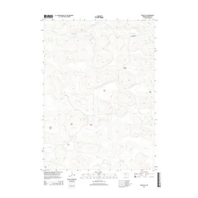
2014 Map of Farm Flat
USGS Topo · Published 2014About this map
Doughboy sits at the northern edge of this Nebraska Sandhills landscape, where the Snake River carves a winding path through the high plains. The terrain is defined by a series of expansive tablelands and depressions, including Farm Flat, Enscow Flat, and School Section Flat, a name reflecting the historical practice of designating specific land sections for the support of local education. Water is a constant presence despite the arid environment, with the drainage of Boardman Cr and Gordon Creek creating a network of small lakes and ponds like Lake John and Badger Lake. To the south, Aljo Hill rises above Evies Flat, providing a prominent landmark in a region characterized by wide valleys such as Peterson Valley and Grove Valley. This map documents a sparsely populated but geographically complex ranching country, showing the intricate relationship between the region's unique hydrology and its naming conventions.
Find a feature on this map
18 named features on this map. Tap any name to fly to it.
Don’t see what you’re looking for? This feature index may not catch every label — zoom into the map to look around manually.
Map Details
Editions of this 2014 Farm Flat Map
This is the sole edition of this map. No revisions or reprints were ever made.
Other maps of this area

1949 · Big Falls
USGS Topo · 1:62,500

1950 · Powderhorn Valley
USGS Topo · 1:62,500

1950 · Doughboy
USGS Topo · 1:62,500

1950 · Wolf Lake
USGS Topo · 1:62,500

1951 · Big Falls
USGS Topo · 1:62,500

1951 · Wolf Lake
USGS Topo · 1:62,500

1952 · Doughboy
USGS Topo · 1:62,500

1957 · Valentine
USGS Topo · 1:250,000

1959 · Valentine
USGS Topo · 1:250,000

1985 · Powderhorn Valley SW
USGS Topo · 1:24,000