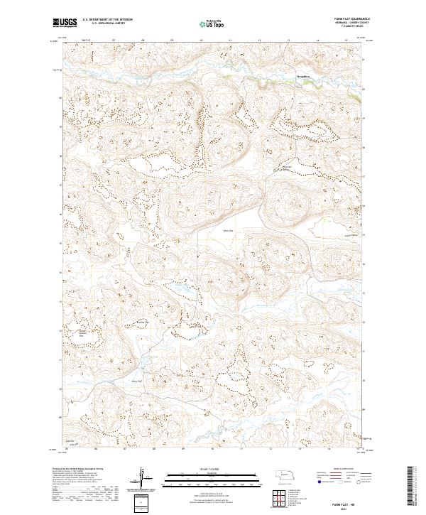
2021 Map of Farm Flat
USGS Topo · Published 2021About this map
Doughboy sits along the northern reaches of the Snake River in this section of Cherry County, where the Sandhills landscape is defined by its named flats and meandering creek systems. The geography here is marked by extensive plateaus such as Farm Flat, Enscow Flat, and Winter Flat, which provide a contrast to the river valleys. A complex network of drainage is visible, featuring Boardman Cr and Gordon Cr, alongside smaller bodies of water like Badger Lake and Lake John. The naming of School Section Flat and Evies Flat points to the long-standing land divisions and local history of the region. To the south, Aljo Hill rises as a distinct landmark above the drainage of Betsy Cr, while the northwestern corner is distinguished by the curving waters of Horseshoe Bend Pond near the riverbanks.
Find a feature on this map
22 named features on this map. Tap any name to fly to it.
Don’t see what you’re looking for? This feature index may not catch every label — zoom into the map to look around manually.
Map Details
Editions of this 2021 Farm Flat Map
This is the sole edition of this map. No revisions or reprints were ever made.
Other maps of this area

1949 · Big Falls
USGS Topo · 1:62,500

1950 · Powderhorn Valley
USGS Topo · 1:62,500

1950 · Doughboy
USGS Topo · 1:62,500

1950 · Wolf Lake
USGS Topo · 1:62,500

1951 · Big Falls
USGS Topo · 1:62,500

1951 · Wolf Lake
USGS Topo · 1:62,500

1952 · Doughboy
USGS Topo · 1:62,500

1957 · Valentine
USGS Topo · 1:250,000

1959 · Valentine
USGS Topo · 1:250,000

1985 · Powderhorn Valley SW
USGS Topo · 1:24,000