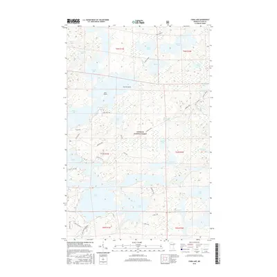
2016 Map of Farm Lake
USGS Topo · Published 2016About this map
Superior National Forest encompasses this water-rich landscape in Lake County, where a complex network of interconnected lakes and portages defines the local geography. The map documents a significant wilderness corridor featuring Farm Lake, Garden Lake, and Fall Lake, which serves as a gateway to the more remote interior. Evidence of historical and modern recreation is visible through the 4-Mile Portage and several dedicated paths such as the Stub Lake Trail and S Farm Ski Trail. The presence of Newton Falls between Newton Lake and Fall Lake illustrates the natural elevation changes that once required manual transport of watercraft. Beyond the larger basins, numerous smaller bodies of water like Ella Hall Lake, Muskeg Lake, and Slumber Lake are scattered throughout the timberland, often accessible only by these established portage routes.
Find a feature on this map
47 named features on this map. Tap any name to fly to it.
Don’t see what you’re looking for? This feature index may not catch every label — zoom into the map to look around manually.
Map Details
Editions of this 2016 Farm Lake Map
This is the sole edition of this map. No revisions or reprints were ever made.
Other maps of this area

1933 · Ely
USGS Topo · 1:62,500

1939 · Ely
USGS Topo · 1:62,500

1954 · Two Harbors
USGS Topo · 1:250,000

1957 · Two Harbors
USGS Topo · 1:250,000

1957 · Gabbro Lake
USGS Topo · 1:62,500

1957 · Basswood Lake
USGS Topo · 1:62,500

1957 · Quetico
USGS Topo · 1:250,000

1958 · Two Harbors
USGS Topo · 1:250,000

1963 · Fourtown Lake
USGS Topo · 1:24,000

1964 · Two Harbors
USGS Topo · 1:250,000