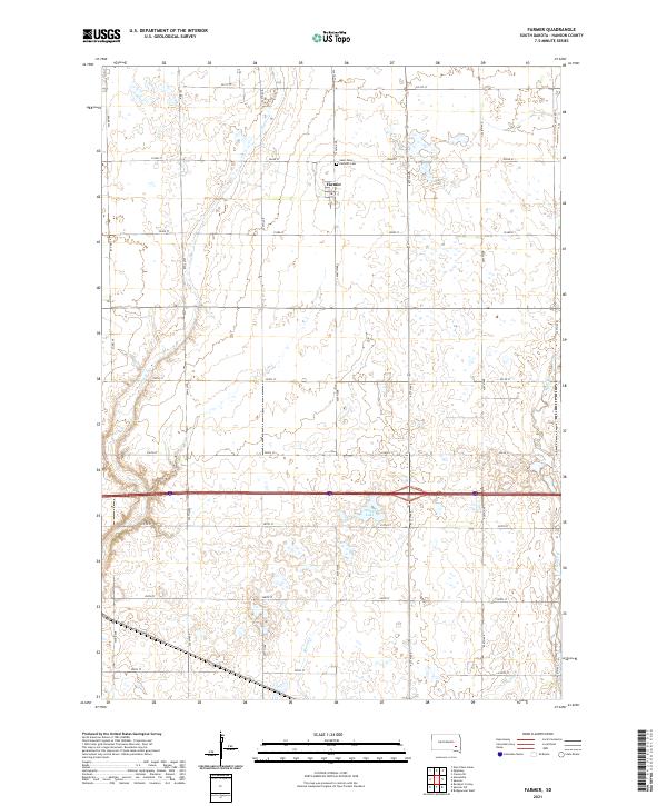
2021 Map of Farmer
USGS Topo · Published 2021About this map
Farmer serves as the central hub for this portion of Hanson County, situated amidst an agricultural landscape defined by section lines and local drainages. The settlement is anchored by the Saint Peters Catholic Cem, a key landmark for genealogists and local historians tracking early families in the region. The terrain is notably water-rich for the plains, featuring several active creek systems including Pierre Cr in the northwest and Bloom Cr flowing through the southern sections. Towards the east, Wolf Cr and Plum Cr carve subtle pathways through the fields, while Welker Lake provides a distinct hydraulic feature south of the main town. The grid of rural routes, such as 426th Ave and 252nd St, illustrates the enduring organization of the South Dakota prairie.
Find a feature on this map
28 named features on this map. Tap any name to fly to it.
Don’t see what you’re looking for? This feature index may not catch every label — zoom into the map to look around manually.
Map Details
Editions of this 2021 Farmer Map
This is the sole edition of this map. No revisions or reprints were ever made.
Other maps of this area

1899 · Alexandria
USGS Topo · 1:125,000

1955 · Sioux Falls
USGS Topo · 1:250,000

1957 · Alexandria
USGS Topo · 1:24,000

1957 · Rockport Colony
USGS Topo · 1:24,000

1958 · Sioux Falls
USGS Topo · 1:250,000

1973 · Spencer SW
USGS Topo · 1:24,000

1973 · Ness Chain Lakes
USGS Topo · 1:24,000

1973 · Farmer
USGS Topo · 1:24,000
1973 · Bridgewater West
USGS Topo · 1:24,000

1973 · Canova SE
USGS Topo · 1:24,000