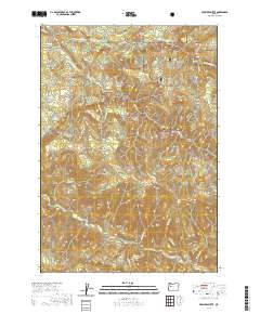
2020 Map of Farmers Butte
USGS Topo · Published 2020About this map
The Cascade Range defines the high-elevation terrain of this 2020 topographic study, situated largely within the Willamette National Forest. This timbered landscape is marked by prominent peaks such as Buck Mtn, Green Butte, and the central landmark of Farmers Butte. The drainage patterns here are significant, with the Calapooia River flowing through the southern portion of the quadrangle, joined by tributaries like Washout Cr. In the northern sections, Wiley Cr and Little Wiley Cr carve deep valleys through the forest, revealing the complex hydrology of the western slopes. Access to this wilderness area is provided by limited forest routes, including Cedar Creek Rd and Wiley Creek Dr, which penetrate the foothills near Doe Mtn. The map preserves the modern state of this protected forest before any recent major changes to the timber or road networks.
Find a feature on this map
25 named features on this map. Tap any name to fly to it.
Don’t see what you’re looking for? This feature index may not catch every label — zoom into the map to look around manually.
Map Details
Editions of this 2020 Farmers Butte Map
This is the sole edition of this map. No revisions or reprints were ever made.
Other maps of this area

1934 · Mc Kenzie Bridge
USGS Topo · 1:96,000

1940 · Mc Kenzie Bridge
USGS Topo · 1:125,000

1951 · Sweet Home
USGS Topo · 1:62,500

1951 · Leaburg
USGS Topo · 1:62,500

1953 · Salem
USGS Topo · 1:250,000

1954 · Salem
USGS Topo · 1:250,000

1955 · Blue River
USGS Topo · 1:62,500

1955 · Cascadia
USGS Topo · 1:62,500

1960 · Salem
USGS Topo · 1:250,000

1962 · Salem
USGS Topo · 1:250,000