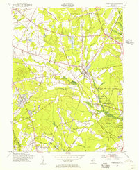
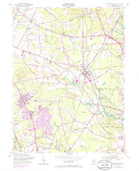
1954 Map of Farmingdale
USGS Topo · Published 1956About this map
The U S Naval Reservation Earle Ammunition Depot dominates the northern landscape of this mid-1950s Monmouth County study, showing the sprawling military presence near the community of Earle. To the south, the Manasquan River and its numerous tributaries like Yellow Brook and Mingamahone Brook define the topography, supporting a landscape of bogs and lowlands such as Bear Swamp. The industrial and transportation identity of the era is preserved through the crossings of the Pennsylvania RR and the Central RR, which intersect at the borough of Farmingdale.
Find a feature on this map
77 named features on this map. Tap any name to fly to it.
Don’t see what you’re looking for? This feature index may not catch every label — zoom into the map to look around manually.
Map Details
Editions of this 1954 Farmingdale Map
6 editions found
Other maps of this area

1888 · New Brunswick
USGS Topo · 1:62,500

1888 · Asbury Park
USGS Topo · 1:62,500

1888 · Cassville
USGS Topo · 1:62,500

1888 · Sandy Hook
USGS Topo · 1:62,500

1893 · New Brunswick
USGS Topo · 1:62,500

1893 · Sandy Hook
USGS Topo · 1:62,500

1893 · Asbury Park
USGS Topo · 1:62,500

1894 · Cassville
USGS Topo · 1:62,500

1900 · Cassville
USGS Topo · 1:62,500

1901 · New Brunswick
USGS Topo · 1:62,500