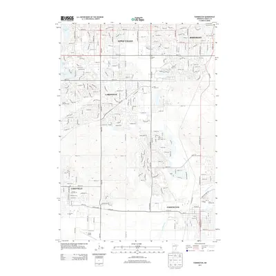
2013 Map of Farmington
USGS Topo · Published 2013About this map
The Vermillion River meanders across the southern landscape of this Dakota County region, marking a natural contrast to the rapid suburban expansion of Apple Valley, Rosemont, and Lakeville. By the early 21st century, the map reveals a dense grid of residential streets and arterial roads like 160th St W and Cedar Ave that have fundamentally transformed former agricultural lands. Despite this growth, numerous local landmarks persist, particularly cemeteries that serve as anchors for genealogical research, including Saint Joseph Cem, Lakeville Grove Cem, and Lebanon Cem.
Find a feature on this map
67 named features on this map. Tap any name to fly to it.
Don’t see what you’re looking for? This feature index may not catch every label — zoom into the map to look around manually.
Map Details
Editions of this 2013 Farmington Map
This is the sole edition of this map. No revisions or reprints were ever made.
Other maps of this area

1896 · Minneapolis
USGS Topo · 1:62,500

1896 · St. Paul
USGS Topo · 1:62,500

1901 · Minneapolis
USGS Topo · 1:62,500

1951 · Inver Grove
USGS Topo · 1:24,000

1951 · St. Paul SW
USGS Topo · 1:24,000

1951 · St. Paul
USGS Topo · 1:62,500

1953 · Saint Paul
USGS Topo · 1:250,000

1954 · Bloomington
USGS Topo · 1:24,000

1954 · Minneapolis
USGS Topo · 1:62,500

1957 · Farmington
USGS Topo · 1:62,500