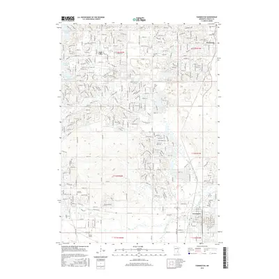
2016 Map of Farmington
USGS Topo · Published 2016About this map
The Vermillion River meanders through the southeastern portion of this landscape, anchoring the city of Farmington. This 2016 survey illustrates the modern residential expansion of Apple Valley and Rosemount as they integrate with the traditional agricultural survey lines of Dakota County. The map is particularly notable for its density of community landmarks, including several denominational burial grounds such as Saint Joseph Cem and Saint Michaels Cem, which serve as vital touchstones for local genealogy. In the southwest, the Airlake Airport indicates the region's industrial and transportation infrastructure. From the shores of Alimagnet Lake to the scattered wetlands in the southern townships, the map documents a transition from suburban residential corridors to the open drainage basins that characterize the upper reaches of the Vermillion watershed.
Find a feature on this map
29 named features on this map. Tap any name to fly to it.
Don’t see what you’re looking for? This feature index may not catch every label — zoom into the map to look around manually.
Map Details
Editions of this 2016 Farmington Map
This is the sole edition of this map. No revisions or reprints were ever made.
Other maps of this area

1896 · Minneapolis
USGS Topo · 1:62,500

1896 · St. Paul
USGS Topo · 1:62,500

1901 · Minneapolis
USGS Topo · 1:62,500

1951 · Inver Grove
USGS Topo · 1:24,000

1951 · St. Paul SW
USGS Topo · 1:24,000

1951 · St. Paul
USGS Topo · 1:62,500

1953 · Saint Paul
USGS Topo · 1:250,000

1954 · Bloomington
USGS Topo · 1:24,000

1954 · Minneapolis
USGS Topo · 1:62,500

1957 · Farmington
USGS Topo · 1:62,500