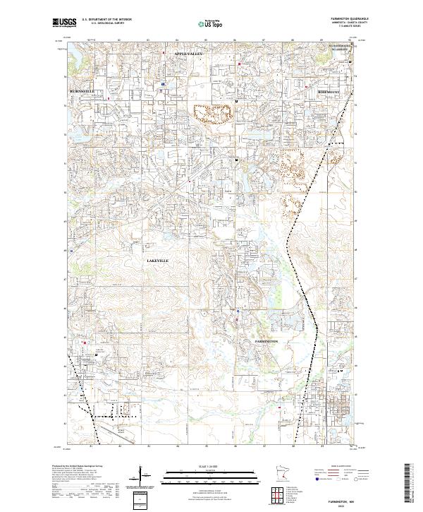
2022 Map of Farmington
USGS Topo · Published 2022About this map
Farmington and the surrounding Dakota County landscape are defined by the convergence of several major watercourses and transport routes. The Vermillion River, along with its North Branch and South Branch, winds through the territory, supporting a network of open spaces like Rambling River Park. This modern survey illustrates the suburban expansion and public infrastructure of the era, from the sprawling campus of Farmington High School to the established Farmington City Hall. For the family historian, the map identifies key religious and memorial sites such as Saint Michaels Church and the Corinthian Cemetery. The importance of the regional rail economy is evident in the active lines of the Union Pacific RR and the Canadian Pacific Railway, which cut through the southern Dakota County plains.
Find a feature on this map
28 named features on this map. Tap any name to fly to it.
Don’t see what you’re looking for? This feature index may not catch every label — zoom into the map to look around manually.
Map Details
Editions of this 2022 Farmington Map
This is the sole edition of this map. No revisions or reprints were ever made.
Historical Maps of Empire Through Time
3 maps found