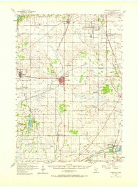
1957 Map of Farmington
USGS Topo · Published 1965About this map
Farmington serves as a central hub for the agricultural and rail landscape of central Dakota County in the late 1950s. The town is a critical junction for the Chicago Milwaukee St Paul and Pacific, providing a link between the scattered farming townships like Eureka and Empire. To the north, the University of Minnesota Rosemount Research Center occupies a significant tract of land near the Rosemount Station, signaling the post-war shift toward institutional research.
Find a feature on this map
63 named features on this map. Tap any name to fly to it.
Don’t see what you’re looking for? This feature index may not catch every label — zoom into the map to look around manually.
Map Details
Editions of this 1957 Farmington Map
2 editions found

Other maps of this area

1896 · Minneapolis
USGS Topo · 1:62,500

1896 · St. Paul
USGS Topo · 1:62,500

1901 · Minneapolis
USGS Topo · 1:62,500

1946 · Hudson
USGS Topo · 1:62,500

1949 · Hudson
USGS Topo · 1:62,500

1950 · St Paul Park
USGS Topo · 1:24,000

1951 · St Paul Park
USGS Topo · 1:24,000

1951 · Inver Grove
USGS Topo · 1:24,000

1951 · St. Paul SW
USGS Topo · 1:24,000

1951 · St. Paul
USGS Topo · 1:62,500