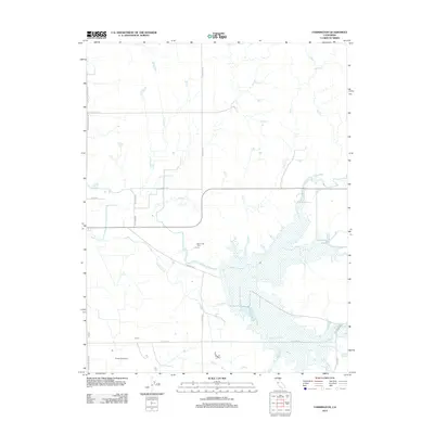
2012 Map of Farmington
USGS Topo · Published 2012About this map
Agricultural operations and water management define this portion of San Joaquin County, where the landscape is marked by the presence of Rock Creek Dairy and Temple Creek Dairy. The terrain is shaped by a dense network of watercourses, including the westward flows of Duck Cr and Littlejohns Cr. A significant hydrological feature, the N Side Canal, cuts through the center of the sheet, reflecting the sophisticated irrigation systems necessary for Central Valley farming. The map also records a transition into more inundated areas near Rock Cr and Hoods Cr toward the east. Long-established regional thoroughfares like E Sonora Rd and E Copperopolis Rd provide the primary infrastructure for the area's dairy and agricultural economy, connecting these rural producers to larger transportation corridors.
Find a feature on this map
22 named features on this map. Tap any name to fly to it.
Don’t see what you’re looking for? This feature index may not catch every label — zoom into the map to look around manually.
Map Details
Editions of this 2012 Farmington Map
This is the sole edition of this map. No revisions or reprints were ever made.
Other maps of this area

1889 · Jackson
USGS Topo · 1:125,000

1892 · Jackson
USGS Topo · 1:125,000

1894 · Lodi
USGS Topo · 1:125,000

1897 · Jackson
USGS Topo · 1:125,000

1902 · Jackson
USGS Topo · 1:125,000

1908 · Linden
USGS Topo · 1:31,680

1914 · Avena
USGS Topo · 1:31,680

1915 · Oakdale
USGS Topo · 1:31,680

1915 · Trigo
USGS Topo · 1:31,680

1915 · Peters
USGS Topo · 1:31,680