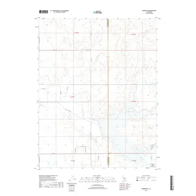
2018 Map of Farmington
USGS Topo · Published 2018About this map
The San Joaquin Valley Central Valley landscape dominates this 2018 survey, defined by a complex network of seasonal creeks and modern irrigation infrastructure. The North Side Canal cuts through the center of the sheet, reflecting the intensive water management required for this agricultural corridor between the San Joaquin and Stanislaus County line. While many of the waterways like Littlejohns Cr, Duck Cr, and Hoods Creek follow meandering natural paths, they are increasingly framed by a rectilinear grid of rural roads and residential developments. Named thoroughfares such as Copperopolis Rd and Escalon Bellota Rd serve as primary arteries, while newer developments are indicated by named residential streets like Via Casilina Pkwy and La Castella Ln. This map captures the evolving boundary between traditional valley ranching and contemporary suburban expansion.
Find a feature on this map
34 named features on this map. Tap any name to fly to it.
Don’t see what you’re looking for? This feature index may not catch every label — zoom into the map to look around manually.
Map Details
Editions of this 2018 Farmington Map
This is the sole edition of this map. No revisions or reprints were ever made.
Other maps of this area

1889 · Jackson
USGS Topo · 1:125,000

1892 · Jackson
USGS Topo · 1:125,000

1894 · Lodi
USGS Topo · 1:125,000

1897 · Jackson
USGS Topo · 1:125,000

1902 · Jackson
USGS Topo · 1:125,000

1908 · Linden
USGS Topo · 1:31,680

1914 · Avena
USGS Topo · 1:31,680

1915 · Oakdale
USGS Topo · 1:31,680

1915 · Trigo
USGS Topo · 1:31,680

1915 · Peters
USGS Topo · 1:31,680