
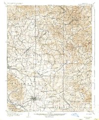
1906 Map of Farmington
USGS Topo · Published 1906About this map
Farmington serves as the focal point of this 1904 survey, showing the town's dense street grid at the intersection of several significant transportation arteries. The surrounding St. Francois and Ste. Genevieve County landscape is defined by a sophisticated early rail network, including the St. Francois County Electric Ry. and the Illinois Southern Ry., which meet at Farmington Junction. These lines, alongside the St. Louis Iron Mtn. and Southern Ry. near Delassus, illustrate the region's transition from a rural frontier to an industrial and agricultural hub.
Find a feature on this map
56 named features on this map. Tap any name to fly to it.
Don’t see what you’re looking for? This feature index may not catch every label — zoom into the map to look around manually.
Map Details
Editions of this 1906 Farmington Map
2 editions found
Other maps of this area

1901 · De Soto
USGS Topo · 1:125,000

1904 · Farmington
USGS Topo · 1:62,500

1905 · Bonneterre
USGS Topo · 1:62,500

1907 · Weingarten
USGS Topo · 1:62,500

1909 · Weingarten
USGS Topo · 1:62,500

1910 · Higdon
USGS Topo · 1:62,500

1915 · Renault
USGS Topo · 1:62,500

1915 · Crystal City
USGS Topo · 1:62,500

1931 · De Soto SE
USGS Topo · 1:24,000

1937 · Ironton
USGS Topo · 1:48,000