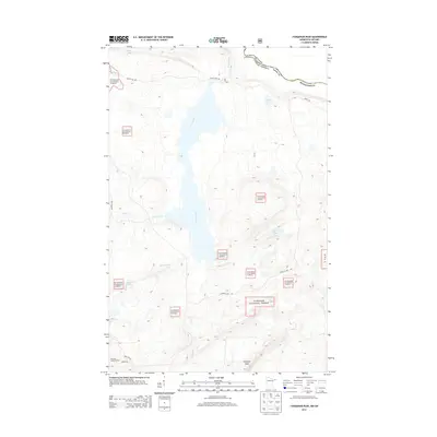
2013 Map of Farquhar Peak
USGS Topo · Published 2013About this map
Farquhar Peak rises above a landscape defined by its remote waterways and the international boundary between Minnesota and Ontario. The Swamp River acts as a central artery through this portion of the Superior National Forest, connecting diverse water bodies such as Otter Lake and Jackson Lake. The terrain is marked by the presence of the Hovland Lookout Tower, a site once critical for fire detection in these dense borderlands. A network of early forest roads, including Otter Lake Rd and Tom Lake Rd, provides the primary access to this high-country drainage basin. The map records the natural hydrology of the region, from the winding course of Irish Creek to the southern reach of the Pigeon River along the Canadian border.
Find a feature on this map
21 named features on this map. Tap any name to fly to it.
Don’t see what you’re looking for? This feature index may not catch every label — zoom into the map to look around manually.
Map Details
Editions of this 2013 Farquhar Peak Map
This is the sole edition of this map. No revisions or reprints were ever made.
Other maps of this area

1954 · Two Harbors
USGS Topo · 1:250,000

1957 · Two Harbors
USGS Topo · 1:250,000

1957 · Quetico
USGS Topo · 1:250,000

1958 · Two Harbors
USGS Topo · 1:250,000

1958 · Hancock
USGS Topo · 1:250,000

1959 · Mineral Center
USGS Topo · 1:24,000

1959 · Pine Lake East
USGS Topo · 1:24,000

1959 · Tom Lake
USGS Topo · 1:24,000

1959 · Fort William
USGS Topo · 1:250,000

1960 · Hancock
USGS Topo · 1:250,000