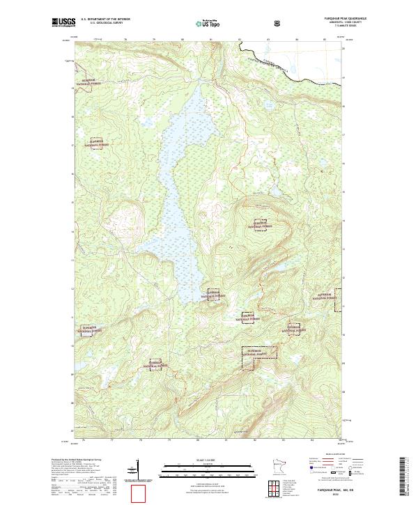
2022 Map of Farquhar Peak
USGS Topo · Published 2022About this map
Superior National Forest blankets this remote stretch of Cook County, where the border between the United States and Canada follows the winding path of the Pigeon River. The landscape is dominated by the sprawling wetlands of the Swamp River, which bisects the quadrangle as it flows north toward the international boundary. These lowlands are contrasted by the high ground of Farquhar Peak in the south and various ridges traversed by the Superior Hiking Trl.
Find a feature on this map
27 named features on this map. Tap any name to fly to it.
Don’t see what you’re looking for? This feature index may not catch every label — zoom into the map to look around manually.
Map Details
Editions of this 2022 Farquhar Peak Map
This is the sole edition of this map. No revisions or reprints were ever made.
Other maps of this area

1954 · Two Harbors
USGS Topo · 1:250,000

1957 · Two Harbors
USGS Topo · 1:250,000

1957 · Quetico
USGS Topo · 1:250,000

1958 · Two Harbors
USGS Topo · 1:250,000

1958 · Hancock
USGS Topo · 1:250,000

1959 · Mineral Center
USGS Topo · 1:24,000

1959 · Pine Lake East
USGS Topo · 1:24,000

1959 · Tom Lake
USGS Topo · 1:24,000

1959 · Fort William
USGS Topo · 1:250,000

1960 · Hancock
USGS Topo · 1:250,000