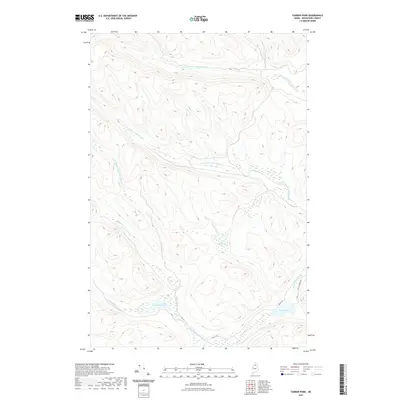
2021 Map of Farrar Pond
USGS Topo · Published 2021About this map
Farrar Pond and the surrounding wetland complex define this corner of the Maine woods, where a complex network of waterways drains the North Maine Woods. The landscape is characterized by the branching headwaters of several major streams, including the southern reaches of Twentymile Brook and the expansive path of Twentyfive Mile Brook. These riparian corridors are punctuated by features like Ketcham Bog, illustrating the saturated, peat-rich terrain typical of Aroostook County. Modern timber management and recreational access are evidenced by the presence of Realty Rd and Jon's Journey Rd, which provide some of the few terrestrial transit points through this dense forest. To the southeast, Pratt Lake and its outflow, Pratt Lake Stream, serve as significant landmarks for those navigating this interior wilderness away from major settlements.
Find a feature on this map
15 named features on this map. Tap any name to fly to it.
Don’t see what you’re looking for? This feature index may not catch every label — zoom into the map to look around manually.
Map Details
Editions of this 2021 Farrar Pond Map
This is the sole edition of this map. No revisions or reprints were ever made.
Other maps of this area

1931 · Fish River Lake
USGS Topo · 1:48,000

1931 · Mooseleuk Lake
USGS Topo · 1:48,000

1932 · Musquacook Lakes
USGS Topo · 1:48,000

1932 · Allagash Falls
USGS Topo · 1:48,000

1935 · Musquacook Lakes
USGS Topo · 1:62,500

1935 · Fish River Lake
USGS Topo · 1:62,500

1935 · Mooseleuk Lake
USGS Topo · 1:62,500

1935 · Allagash Falls
USGS Topo · 1:62,500

1954 · Presque Isle
USGS Topo · 1:250,000

1956 · Allagash Falls
USGS Topo · 1:50,000