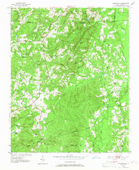
1951 Map of Farrington
USGS Topo · Published 1967About this map
Edwards Mountain and Boothe Hill anchor a heavily wooded landscape in Chatham and Orange Counties during the early 1950s. This survey records a rural society organized around crossroads churches and small family holdings before regional development transformed the Piedmont. The settlement at Farrington sits near the Norfolk Southern rail line and the New Hope River, which meanders through the eastern portion of the quadrangle alongside Bush Creek.
Find a feature on this map
55 named features on this map. Tap any name to fly to it.
Don’t see what you’re looking for? This feature index may not catch every label — zoom into the map to look around manually.
Map Details
Editions of this 1951 Farrington Map
3 editions found
Other maps of this area

1943 · Durham South
USGS Topo · 1:62,500

1946 · Chapel Hill
USGS Topo · 1:24,000

1947 · Chapel Hill
USGS Topo · 1:31,680

1951 · Farrington
USGS Topo · 1:24,000

1951 · Durham South
USGS Topo · 1:62,500

1953 · Raleigh
USGS Topo · 1:250,000

1954 · Raleigh
USGS Topo · 1:250,000

1968 · White Cross
USGS Topo · 1:24,000

1968 · Bynum
USGS Topo · 1:24,000

1969 · New Hope Dam
USGS Topo · 1:24,000