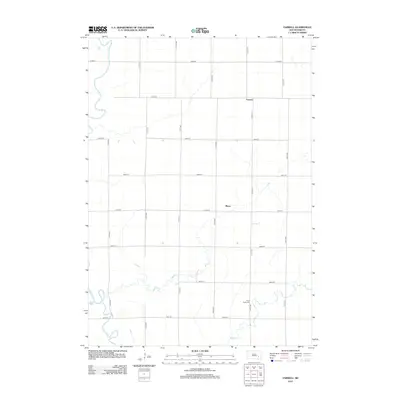
2012 Map of Farwell
USGS Topo · Published 2012About this map
The James River snakes through the western edge of this prairie landscape in Hanson County, defining the drainage patterns for the surrounding farmland. This agricultural region is anchored by the small settlements of Farwell and Plano, connected by a precise grid of section-line roads like 415th Ave and 247th St. The meandering path of the river, along with its tributary Dry Run, creates a distinct break in the otherwise orderly township layout, suggesting the historical importance of these water sources to early homesteaders. To the southeast, Rock Creek flows through the township, near which the Rock Creek Cem stands as a primary genealogical landmark for local family history research. This map captures the enduring rural character of the South Dakota plains, where the relationship between the river valley and the surveyed road network remains the primary structural element of the community.
Find a feature on this map
20 named features on this map. Tap any name to fly to it.
Don’t see what you’re looking for? This feature index may not catch every label — zoom into the map to look around manually.
Map Details
Editions of this 2012 Farwell Map
This is the sole edition of this map. No revisions or reprints were ever made.
Other maps of this area

1899 · Mitchell
USGS Topo · 1:125,000

1899 · Alexandria
USGS Topo · 1:125,000

1955 · Sioux Falls
USGS Topo · 1:250,000

1955 · Mitchell
USGS Topo · 1:250,000

1957 · Alexandria
USGS Topo · 1:24,000

1957 · Farwell NW
USGS Topo · 1:24,000

1957 · Loomis
USGS Topo · 1:24,000

1957 · Riverside
USGS Topo · 1:24,000

1957 · Letcher NE
USGS Topo · 1:24,000

1957 · Farwell
USGS Topo · 1:24,000