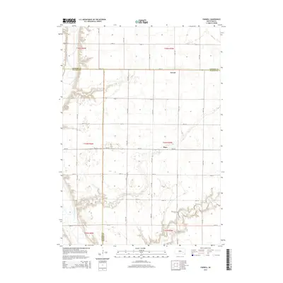
2015 Map of Farwell
USGS Topo · Published 2015About this map
Farwell and Plano represent the quiet, grid-based agricultural communities that define the prairie landscape of eastern South Dakota. This 2015 snapshot captures the intersection of Sanborn, Davison, and Hanson counties, where the land is meticulously partitioned by township and range lines. The James River winds through the western edge of the quadrangle, while Rock Cr cuts across the southeastern corner, providing essential drainage for the surrounding farmland. Genealogists and local historians will find the Rock Creek Cem a significant landmark within this rural layout, situated south of Plano. The map's detailed road network, including routes like 244th St and 414th Ave, illustrates the persistence of the section-line road system that has governed transport and property boundaries in the region for generations.
Find a feature on this map
28 named features on this map. Tap any name to fly to it.
Don’t see what you’re looking for? This feature index may not catch every label — zoom into the map to look around manually.
Map Details
Editions of this 2015 Farwell Map
This is the sole edition of this map. No revisions or reprints were ever made.
Other maps of this area

1899 · Mitchell
USGS Topo · 1:125,000

1899 · Alexandria
USGS Topo · 1:125,000

1955 · Sioux Falls
USGS Topo · 1:250,000

1955 · Mitchell
USGS Topo · 1:250,000

1957 · Alexandria
USGS Topo · 1:24,000

1957 · Farwell NW
USGS Topo · 1:24,000

1957 · Loomis
USGS Topo · 1:24,000

1957 · Riverside
USGS Topo · 1:24,000

1957 · Letcher NE
USGS Topo · 1:24,000

1957 · Farwell
USGS Topo · 1:24,000