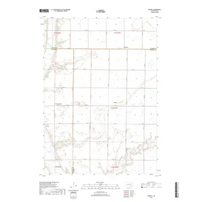
2017 Map of Farwell
USGS Topo · Published 2017About this map
Farwell and Plano represent the quiet rural centers of this landscape where the boundaries of Sanborn, Davison, and Hanson counties converge. The terrain is defined by the winding course of the James River in the northwest and the drainage of Rock Cr to the south. Local history is anchored at the Rock Creek Cem, a significant landmark for genealogical research in this part of South Dakota. The map reveals a strictly organized grid of agricultural section lines, including Piano Rd and several numeric avenues that facilitate travel between these small settlements. This survey illustrates the persistent importance of the section-line road system in maintaining the connectivity of the prairie's dispersed farmsteads and township communities.
Find a feature on this map
30 named features on this map. Tap any name to fly to it.
Don’t see what you’re looking for? This feature index may not catch every label — zoom into the map to look around manually.
Map Details
Editions of this 2017 Farwell Map
This is the sole edition of this map. No revisions or reprints were ever made.
Other maps of this area

1899 · Mitchell
USGS Topo · 1:125,000

1899 · Alexandria
USGS Topo · 1:125,000

1955 · Sioux Falls
USGS Topo · 1:250,000

1955 · Mitchell
USGS Topo · 1:250,000

1957 · Alexandria
USGS Topo · 1:24,000

1957 · Farwell NW
USGS Topo · 1:24,000

1957 · Loomis
USGS Topo · 1:24,000

1957 · Riverside
USGS Topo · 1:24,000

1957 · Letcher NE
USGS Topo · 1:24,000

1957 · Farwell
USGS Topo · 1:24,000