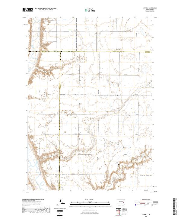
2021 Map of Farwell
USGS Topo · Published 2021About this map
The James River meanders along the western edge of this prairie landscape, joined by the winding course of Rock Cr in the southern reaches of the quadrangle. This area, spanning the intersection of Sanborn, Davison, and Hanson Counties, is characterized by a precise grid of rural roads and scattered small-scale settlements. The community of Farwell sits near the northern boundary, while Plano is situated further south, serving as local centers for the surrounding agricultural tracts. Genealogy and local history researchers will find the Rock Creek Cem located near the southern fork of its namesake creek. The map illustrates a classic South Dakota township structure, where the section lines are clearly marked by gravel and paved routes like Co Hwy 36 and Piano Rd, showing the enduring organization of the land for farming and settlement.
Find a feature on this map
30 named features on this map. Tap any name to fly to it.
Don’t see what you’re looking for? This feature index may not catch every label — zoom into the map to look around manually.
Map Details
Editions of this 2021 Farwell Map
This is the sole edition of this map. No revisions or reprints were ever made.
Other maps of this area

1899 · Mitchell
USGS Topo · 1:125,000

1899 · Alexandria
USGS Topo · 1:125,000

1955 · Sioux Falls
USGS Topo · 1:250,000

1955 · Mitchell
USGS Topo · 1:250,000

1957 · Alexandria
USGS Topo · 1:24,000

1957 · Farwell NW
USGS Topo · 1:24,000

1957 · Loomis
USGS Topo · 1:24,000

1957 · Riverside
USGS Topo · 1:24,000

1957 · Letcher NE
USGS Topo · 1:24,000

1957 · Farwell
USGS Topo · 1:24,000