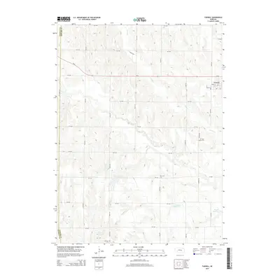
2014 Map of Farwell
USGS Topo · Published 2014About this map
The village of Farwell serves as the primary settlement in this Howard County landscape, situated along Ne-92 near the border with Sherman County. The area's agricultural identity is shaped by a complex network of waterways, including Turkey Cr, Oak Cr, and Deer Cr, which feed into several man-made impoundments. Significant local landmarks include the Farwell Reservoir, Christensen Reservoir, and Krogh Reservoir, reflecting the region's managed water resources. For those researching local heritage, the map identifies several rural burial sites, such as Danish Cem, Saint Anthony Cem, Kelso Cem, and Ebenezer Cem, which are scattered throughout the township grid. The topography is defined by a dense section-line road system, with routes like Valley Rd, Wausau Rd, and Salem Rd connecting the outlying farmsteads to the central hub of Farwell.
Find a feature on this map
34 named features on this map. Tap any name to fly to it.
Don’t see what you’re looking for? This feature index may not catch every label — zoom into the map to look around manually.
Map Details
Editions of this 2014 Farwell Map
This is the sole edition of this map. No revisions or reprints were ever made.
Other maps of this area

1899 · Loup
USGS Topo · 1:125,000

1953 · Dannebrog
USGS Topo · 1:24,000

1953 · Cotesfield
USGS Topo · 1:24,000

1953 · Rockville
USGS Topo · 1:24,000

1953 · Boelus
USGS Topo · 1:24,000

1953 · Loup City SE
USGS Topo · 1:24,000

1953 · Farwell
USGS Topo · 1:24,000

1953 · Nysted
USGS Topo · 1:24,000

1953 · Ashton
USGS Topo · 1:24,000

1953 · Elba
USGS Topo · 1:24,000