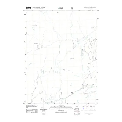
2011 Map of Farwell Mountain
USGS Topo · Published 2011About this map
Farwell Mountain and the surrounding peaks of Routt County define this high-elevation landscape, where the headwaters of the Elk River gather from numerous creeks and canyons. The area reflects a history of mineral exploration, evidenced by the King Solomon Creek Mine, the Farwell Mountain Northwest Mine, and the Zinc Mountain Mine. These sites are linked by a network of forest roads including Seedhouse Rd and Co Rd 64, which follow the river valleys between the mountain's steep slopes and various open meadows. Notable topographical features like Hinman Canyon and the curiously named Hole-in-Wall Canyon carve through the terrain, while large natural clearings such as Diamond Park, Hinman Park, and Boulder Park provide distinct breaks in the forest cover. This map captures the confluence of the Middle Fork Elk River and South Fork Elk River, illustrating the complex drainage system that feeds the lower valleys.
Find a feature on this map
31 named features on this map. Tap any name to fly to it.
Don’t see what you’re looking for? This feature index may not catch every label — zoom into the map to look around manually.
Map Details
Editions of this 2011 Farwell Mountain Map
This is the sole edition of this map. No revisions or reprints were ever made.
Other maps of this area

1911 · Hahns Peak
USGS Topo · 1:125,000

1913 · Hahns Peak
USGS Topo · 1:125,000

1954 · Craig
USGS Topo · 1:250,000

1955 · Davis Peak
USGS Topo · 1:24,000

1955 · Mount Zirkel
USGS Topo · 1:24,000

1955 · Mount Ethel
USGS Topo · 1:24,000

1955 · Mount Ethel
USGS Topo · 1:62,500

1956 · Pearl
USGS Topo · 1:62,500

1957 · Craig
USGS Topo · 1:250,000

1958 · Craig
USGS Topo · 1:250,000