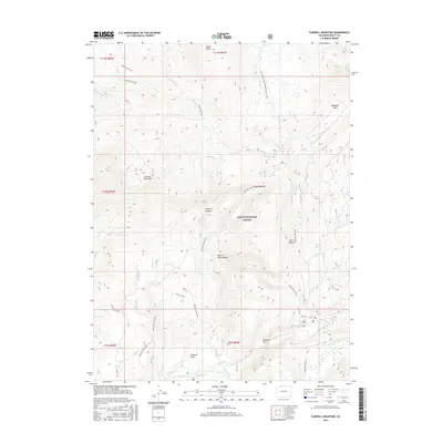
2016 Map of Farwell Mountain
USGS Topo · Published 2016About this map
Routt National Forest dominates this high-altitude landscape in northern Colorado, centered on the prominent peak of Farwell Mountain. The terrain is defined by a series of steep drainages and glaciated valleys, notably Hinman Canyon and Hole-in-Wall Canyon, which feed into the Elk River system. The map documents a complex network of back-country routes, including the Continental Divide National Scenic Trail and the Hinman Creek Trail, which provide access to secluded openings like Hinman Park and Boulder Park. A distinct hydrological pattern emerges as several tributaries, including Coulton Cr and Scott Run, converge toward the Middle Fork Elk River and S Fork Elk River in the south. This 2016 survey captures the area's transition from rocky summits like Dome Peak to the meadowlands of Diamond Park near the N Fork Elk Creek, reflecting the preserved character of this wilderness area.
Find a feature on this map
38 named features on this map. Tap any name to fly to it.
Don’t see what you’re looking for? This feature index may not catch every label — zoom into the map to look around manually.
Map Details
Editions of this 2016 Farwell Mountain Map
This is the sole edition of this map. No revisions or reprints were ever made.
Other maps of this area

1911 · Hahns Peak
USGS Topo · 1:125,000

1913 · Hahns Peak
USGS Topo · 1:125,000

1954 · Craig
USGS Topo · 1:250,000

1955 · Davis Peak
USGS Topo · 1:24,000

1955 · Mount Zirkel
USGS Topo · 1:24,000

1955 · Mount Ethel
USGS Topo · 1:24,000

1955 · Mount Ethel
USGS Topo · 1:62,500

1956 · Pearl
USGS Topo · 1:62,500

1957 · Craig
USGS Topo · 1:250,000

1958 · Craig
USGS Topo · 1:250,000