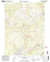
2000 Map of Farwell Mountain
USGS Topo · Published 2004About this map
The high-elevation drainage of the Elk River defines this portion of the Routt National Forest, where the landscape is carved by steep canyons and alpine creeks. Around Hinman Park and the settlement of Hinman, the confluence of the North Fork and Middle Fork created a natural hub for forest management, anchored by the Seedhouse Guard Sta and the Seedhouse locality. To the north, the terrain rises sharply toward Farwell Mountain and Dome Peak, with numerous spring-fed tributaries like Silver City Creek and King Solomon Creek cutting through unsurveyed protracted blocks.
Find a feature on this map
49 named features on this map. Tap any name to fly to it.
Don’t see what you’re looking for? This feature index may not catch every label — zoom into the map to look around manually.
Map Details
Editions of this 2000 Farwell Mountain Map
This is the sole edition of this map. No revisions or reprints were ever made.
Other maps of this area

1911 · Hahns Peak
USGS Topo · 1:125,000

1913 · Hahns Peak
USGS Topo · 1:125,000

1954 · Craig
USGS Topo · 1:250,000

1955 · Davis Peak
USGS Topo · 1:24,000

1955 · Mount Zirkel
USGS Topo · 1:24,000

1955 · Mount Ethel
USGS Topo · 1:24,000

1955 · Mount Ethel
USGS Topo · 1:62,500

1956 · Pearl
USGS Topo · 1:62,500

1957 · Craig
USGS Topo · 1:250,000

1958 · Craig
USGS Topo · 1:250,000