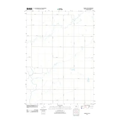
2012 Map of Farwell NW
USGS Topo · Published 2012About this map
The James River meanders through this agricultural landscape in Sanborn County, where a strict grid of section line roads defines the prairie terrain. Established thoroughfares like 240th St and 411th Ave carve the land into precise segments, reflecting the late 20th-century development of rural South Dakota infrastructure. Natural drainage patterns interrupt this geometric order, most notably the winding course of Jim Cr in the northern portion and the intermittent Dry Run through the center. These waterways provide a stark contrast to the straight-line reliability of the surrounding road network, such as 234th St and 416th Ave. The map captures a moment in the early 21st century when the traditional homestead layout remained visible through the intersection of these local routes.
Find a feature on this map
18 named features on this map. Tap any name to fly to it.
Don’t see what you’re looking for? This feature index may not catch every label — zoom into the map to look around manually.
Map Details
Editions of this 2012 Farwell NW Map
This is the sole edition of this map. No revisions or reprints were ever made.
Other maps of this area

1898 · Huron
USGS Topo · 1:125,000

1899 · Mitchell
USGS Topo · 1:125,000

1899 · Alexandria
USGS Topo · 1:125,000

1899 · De Smet
USGS Topo · 1:125,000

1953 · Huron
USGS Topo · 1:250,000

1953 · Watertown
USGS Topo · 1:250,000

1954 · Huron
USGS Topo · 1:250,000

1955 · Sioux Falls
USGS Topo · 1:250,000

1955 · Mitchell
USGS Topo · 1:250,000

1957 · Farwell NW
USGS Topo · 1:24,000
Featured Places
- Union Township, SD
- Butler Township, SD
- Upland Hutterite Colony, SD
- Diana Township, SD
- Ravenna Township, SD