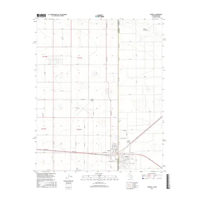
2016 Map of Farwell
USGS Topo · Published 2016About this map
The sister border towns of Texico and Farwell straddle the state line where the high plains of New Mexico meet the Texas Panhandle. This survey captures a landscape defined by its rigid section lines and agricultural layout, centered on the historic transportation corridor of Wheeler Ave. The map highlights important local landmarks including the Clovis Municipal Airport and the Sunset Terrace Memorial Cem, which serves as a significant genealogical site for the community. The northern portion of the quadrangle is marked by the winding path of Running Water Draw, a distinctive topographical break in the otherwise flat terrain. Residential and commercial development is concentrated along the border, with street names like Hereford Ave and Leftwich Ave defining the urban core of these intertwined settlements.
Find a feature on this map
39 named features on this map. Tap any name to fly to it.
Don’t see what you’re looking for? This feature index may not catch every label — zoom into the map to look around manually.
Map Details
Editions of this 2016 Farwell Map
This is the sole edition of this map. No revisions or reprints were ever made.
Other maps of this area

1954 · Clovis
USGS Topo · 1:250,000

1957 · Clovis
USGS Topo · 1:62,500

1957 · Pleasant Hill
USGS Topo · 1:62,500

1958 · Clovis
USGS Topo · 1:250,000

1963 · Lariat
USGS Topo · 1:24,000

1963 · Oklahoma Lane
USGS Topo · 1:24,000

1965 · Bovina
USGS Topo · 1:24,000

1985 · Midway
USGS Topo · 1:24,000

1985 · Pleasure Lake
USGS Topo · 1:24,000

1985 · Muleshoe
USGS Topo · 1:100,000