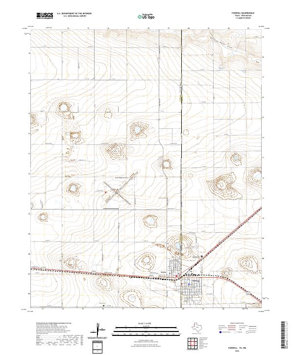
2022 Map of Farwell
USGS Topo · Published 2022About this map
Texico and Farwell straddle the prominent state line between New Mexico and Texas, forming a unique twin-town settlement pattern where the High Plains grid is interrupted only by the diagonal path of the regional rail line. The presence of the Parmer County Courthouse in Farwell marks it as a local center of civic authority, while the nearby Texico Cem and Sunset Terrace Memorial Cem provide vital points of interest for genealogical research. To the north, the modern infrastructure of Clovis Regional Airport occupies a large expanse of the flat terrain. The landscape is primarily defined by a geometric network of section roads like Co RD 16 and C R 12, though the natural topography of Running Water Draw cuts across the northeastern corner, indicating the ancient drainage patterns of this arid region.
Find a feature on this map
44 named features on this map. Tap any name to fly to it.
Don’t see what you’re looking for? This feature index may not catch every label — zoom into the map to look around manually.
Map Details
Editions of this 2022 Farwell Map
This is the sole edition of this map. No revisions or reprints were ever made.
Other maps of this area

1954 · Clovis
USGS Topo · 1:250,000

1957 · Clovis
USGS Topo · 1:62,500

1957 · Pleasant Hill
USGS Topo · 1:62,500

1958 · Clovis
USGS Topo · 1:250,000

1963 · Lariat
USGS Topo · 1:24,000

1963 · Oklahoma Lane
USGS Topo · 1:24,000

1965 · Bovina
USGS Topo · 1:24,000

1985 · Midway
USGS Topo · 1:24,000

1985 · Pleasure Lake
USGS Topo · 1:24,000

1985 · Muleshoe
USGS Topo · 1:100,000