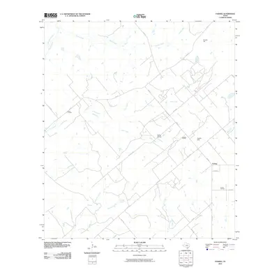
2010 Map of Fashing
USGS Topo · Published 2010About this map
Fashing serves as the focal point for this South Texas rural landscape, where the local economy and geography are defined by a mix of ranching and energy extraction. The map highlights the extensive energy infrastructure of the region, including the Fashing Edwards Gas Field and the Weigang Oil Field. These industrial sites sit amidst a drainage network of creeks, such as Water Creek, Lipan Creek, and Tordillo Creek, which cut through the undulating terrain of the Tordillo Hills. For genealogists and local historians, the presence of Brister Cemetery and Fashing Cemetery provide vital points of connection to the area's early families. The road network, including Oil People Rd and various Farm to Market roads, illustrates how petroleum interests shaped the development of transport routes across these coastal plains.
Find a feature on this map
31 named features on this map. Tap any name to fly to it.
Don’t see what you’re looking for? This feature index may not catch every label — zoom into the map to look around manually.
Map Details
Editions of this 2010 Fashing Map
This is the sole edition of this map. No revisions or reprints were ever made.
Other maps of this area

1925 · Tordia No. 1
USGS Topo · 1:48,000

1930 · Whitsett
USGS Topo · 1:62,500

1931 · Falls City
USGS Topo · 1:62,500

1942 · Whitsett
USGS Topo · 1:62,500

1953 · Crystal City
USGS Topo · 1:250,000

1955 · Crystal City
USGS Topo · 1:250,000

1956 · Suniland
USGS Topo · 1:62,500

1956 · Pleasanton
USGS Topo · 1:62,500

1961 · Crystal City
USGS Topo · 1:250,000
1961 · Falls City
USGS Topo · 1:24,000