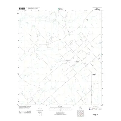
2013 Map of Fashing
USGS Topo · Published 2013About this map
Fashing serves as the primary hub in this South Texas landscape, where the local economy is visibly shaped by the energy industry. The presence of the Fashing Edwards Gas Field and the Weigang Oil Field, alongside the aptly named Oil People Rd, illustrates the intensive resource extraction that characterizes the region. The terrain is defined by a series of intermittent watercourses including Los Cortes Cr, Water Cr, and Olmos Cr, which carve through the plains near Tordillo Hill. Genealogists will find interest in the documented locations of Brister Cem and Fashing Cem, providing a clear record of local family history and settlement patterns within Atascosa County.
Find a feature on this map
37 named features on this map. Tap any name to fly to it.
Don’t see what you’re looking for? This feature index may not catch every label — zoom into the map to look around manually.
Map Details
Editions of this 2013 Fashing Map
This is the sole edition of this map. No revisions or reprints were ever made.
Other maps of this area

1925 · Tordia No. 1
USGS Topo · 1:48,000

1930 · Whitsett
USGS Topo · 1:62,500

1931 · Falls City
USGS Topo · 1:62,500

1942 · Whitsett
USGS Topo · 1:62,500

1953 · Crystal City
USGS Topo · 1:250,000

1955 · Crystal City
USGS Topo · 1:250,000

1956 · Suniland
USGS Topo · 1:62,500

1956 · Pleasanton
USGS Topo · 1:62,500

1961 · Crystal City
USGS Topo · 1:250,000
1961 · Falls City
USGS Topo · 1:24,000