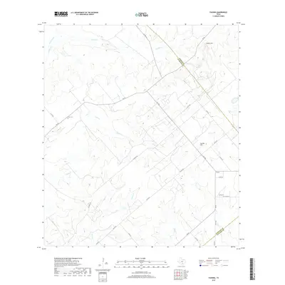
2019 Map of Fashing
USGS Topo · Published 2019About this map
The unincorporated community of Fashing sits at the intersection of local routes in a landscape defined by ranching and the energy industry. This rural portion of Atascosa County is notably bisected by Oil People Rd, a name reflecting the local economic history of oil and gas exploration in South Texas. The area is heavily marked by a network of drainage systems, including Lipan Cr, Water Cr, and the various forks of Olmos Cr, which carve through the terrain toward the south and west.
Find a feature on this map
34 named features on this map. Tap any name to fly to it.
Don’t see what you’re looking for? This feature index may not catch every label — zoom into the map to look around manually.
Map Details
Editions of this 2019 Fashing Map
This is the sole edition of this map. No revisions or reprints were ever made.
Other maps of this area

1925 · Tordia No. 1
USGS Topo · 1:48,000

1930 · Whitsett
USGS Topo · 1:62,500

1931 · Falls City
USGS Topo · 1:62,500

1942 · Whitsett
USGS Topo · 1:62,500

1953 · Crystal City
USGS Topo · 1:250,000

1955 · Crystal City
USGS Topo · 1:250,000

1956 · Suniland
USGS Topo · 1:62,500

1956 · Pleasanton
USGS Topo · 1:62,500

1961 · Crystal City
USGS Topo · 1:250,000
1961 · Falls City
USGS Topo · 1:24,000