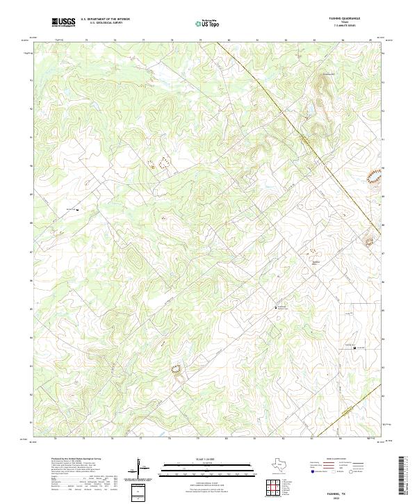
2022 Map of Fashing
USGS Topo · Published 2022About this map
Tordillo Hills dominate this portion of South Texas where the boundaries of Atascosa, Karnes, and Live Oak counties meet. The landscape is defined by a dense network of intermittent drainages including Tordillo Cr, Lipan Cr, and Water Cr, which carve through the terrain near the prominent Tordillo Hill. Local family and community history is anchored by several burial sites, such as the Brister Cem in the northwest and the Guadalupe Catholic Cem further south. The presence of Oil People Rd points to the region's long-standing connection to the petroleum industry, reflecting a rural economy built on both ranching and mineral extraction. A web of secondary routes like FM 791 and FM 2924 connects these dispersed homesteads and landmarks, illustrating the persistent settlement patterns of this brush country borderland.
Find a feature on this map
35 named features on this map. Tap any name to fly to it.
Don’t see what you’re looking for? This feature index may not catch every label — zoom into the map to look around manually.
Map Details
Editions of this 2022 Fashing Map
This is the sole edition of this map. No revisions or reprints were ever made.
Other maps of this area

1925 · Tordia No. 1
USGS Topo · 1:48,000

1930 · Whitsett
USGS Topo · 1:62,500

1931 · Falls City
USGS Topo · 1:62,500

1942 · Whitsett
USGS Topo · 1:62,500

1953 · Crystal City
USGS Topo · 1:250,000

1955 · Crystal City
USGS Topo · 1:250,000

1956 · Suniland
USGS Topo · 1:62,500

1956 · Pleasanton
USGS Topo · 1:62,500

1961 · Crystal City
USGS Topo · 1:250,000
1961 · Falls City
USGS Topo · 1:24,000