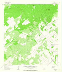
1961 Map of Fashing
USGS Topo · Published 1964About this map
Fashing Edwards Gas Field dominates the landscape of this 1961 survey, where the industry of natural gas extraction meets the agricultural patterns of South Texas. Numerous Gas Wells and pipelines crisscross the terrain, particularly concentrated along the Tordillo Hills and the winding course of Lipan Creek. The settlement of Fashing sits at a crossroads near the eastern edge of the quadrangle, serving as a hub for the surrounding ranching and drilling operations.
Find a feature on this map
25 named features on this map. Tap any name to fly to it.
Don’t see what you’re looking for? This feature index may not catch every label — zoom into the map to look around manually.
Map Details
Editions of this 1961 Fashing Map
This is the sole edition of this map. No revisions or reprints were ever made.
Other maps of this area

1925 · Tordia No. 1
USGS Topo · 1:48,000

1930 · Whitsett
USGS Topo · 1:62,500

1931 · Falls City
USGS Topo · 1:62,500

1942 · Whitsett
USGS Topo · 1:62,500

1953 · Crystal City
USGS Topo · 1:250,000

1955 · Crystal City
USGS Topo · 1:250,000

1956 · Suniland
USGS Topo · 1:62,500

1956 · Pleasanton
USGS Topo · 1:62,500

1961 · Crystal City
USGS Topo · 1:250,000
1961 · Falls City
USGS Topo · 1:24,000