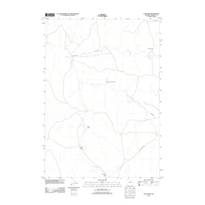
2012 Map of Fats Draw
USGS Topo · Published 2012About this map
Fats Draw and the surrounding high plains of Campbell County are defined by a network of seasonal watercourses and remote ranching operations. The drainage systems of Pumpkin Cr dominate the landscape, branching into the N Prong Pumpkin Cr, Middle Prong Pumpkin Cr, and S Prong Pumpkin Cr. These waterways dictate the placement of established homesteads and livestock operations, including the Saunders Ranch and Gilkie Ranch in the northern portion of the quadrangle. Further south, the terrain descends toward Hartzog Draw near the Christensen North Ranch. Transportation in this isolated region relies on a few primary corridors like Iberlin Rd and the Black and Yellow Rd. A notable modern landmark is the Iberlin Ranch Airport Nr 1, which provides a vital air link for this sprawling ranching country.
Find a feature on this map
14 named features on this map. Tap any name to fly to it.
Don’t see what you’re looking for? This feature index may not catch every label — zoom into the map to look around manually.
Map Details
Editions of this 2012 Fats Draw Map
This is the sole edition of this map. No revisions or reprints were ever made.
Other maps of this area

1953 · Fort Reno SE
USGS Topo · 1:24,000

1953 · Savageton
USGS Topo · 1:24,000

1953 · Fats Draw
USGS Topo · 1:24,000

1953 · The Nipple
USGS Topo · 1:24,000

1953 · North Butte
USGS Topo · 1:24,000

1954 · Gillette
USGS Topo · 1:250,000

1955 · Newcastle
USGS Topo · 1:250,000

1955 · Sheridan
USGS Topo · 1:250,000

1955 · Arminto
USGS Topo · 1:250,000

1955 · Gillette
USGS Topo · 1:250,000