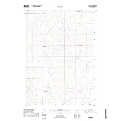
2017 Map of Fats Draw
USGS Topo · Published 2017About this map
Pumpkin Creek and its many tributaries carve a complex drainage pattern across this section of Campbell County. The landscape is defined by its pronged waterways, including the North Prong Pumpkin Creek, Middle Prong Pumpkin Creek, and South Prong Pumpkin Creek. This 2017 survey reveals the intricate topography of the high plains, where named erosional features like Fats Draw and Hartzog Draw serve as primary landmarks in a region largely devoid of concentrated settlements. Human presence is marked primarily by the rural road network, with Iberlin Road cutting through the center and the historically named Black and Yellow Road crossing the southern portion. This map is an essential reference for understanding the hydrological structure of the region and the grazing lands bounded by Nut Creek.
Find a feature on this map
15 named features on this map. Tap any name to fly to it.
Don’t see what you’re looking for? This feature index may not catch every label — zoom into the map to look around manually.
Map Details
Editions of this 2017 Fats Draw Map
This is the sole edition of this map. No revisions or reprints were ever made.
Other maps of this area

1953 · Fort Reno SE
USGS Topo · 1:24,000

1953 · Savageton
USGS Topo · 1:24,000

1953 · Fats Draw
USGS Topo · 1:24,000

1953 · The Nipple
USGS Topo · 1:24,000

1953 · North Butte
USGS Topo · 1:24,000

1954 · Gillette
USGS Topo · 1:250,000

1955 · Newcastle
USGS Topo · 1:250,000

1955 · Sheridan
USGS Topo · 1:250,000

1955 · Arminto
USGS Topo · 1:250,000

1955 · Gillette
USGS Topo · 1:250,000