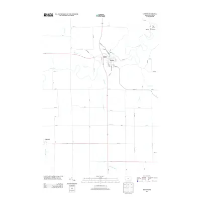
2013 Map of Fayette
USGS Topo · Published 2013About this map
The Volga River winds through the heart of this Iowa landscape, defining the character of the settlement at Fayette and the nearby community of Albany. This 2013 survey illustrates the local dependence on the river valley's geography, where the town grid of Fayette sits just north of a sharp bend in the water. To the northeast, Frog Hollow and the Volga River Campground suggest a terrain utilized for recreation and natural preservation alongside the more traditional agricultural grid that dominates the surrounding townships.
Find a feature on this map
54 named features on this map. Tap any name to fly to it.
Don’t see what you’re looking for? This feature index may not catch every label — zoom into the map to look around manually.
Map Details
Editions of this 2013 Fayette Map
This is the sole edition of this map. No revisions or reprints were ever made.
Other maps of this area

1901 · Oelwein
USGS Topo · 1:125,000

1959 · Dubuque
USGS Topo · 1:250,000

1961 · Dubuque
USGS Topo · 1:250,000

1962 · Dubuque
USGS Topo · 1:250,000

1965 · Elgin
USGS Topo · 1:24,000

1965 · Wadena
USGS Topo · 1:24,000

1965 · Arlington
USGS Topo · 1:24,000

1976 · Dubuque
USGS Topo · 1:250,000
1981 · Stanley
USGS Topo · 1:24,000
1981 · Maynard
USGS Topo · 1:24,000