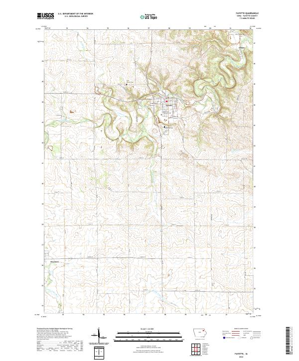
2022 Map of Fayette
USGS Topo · Published 2022About this map
Upper Iowa University anchors the heart of Fayette, a community defined by its proximity to the winding curves of the Volga River. The landscape transitions from the campus and residential grid of Fayette to the surrounding agricultural sections of Fayette County, where the Little Volga River and Alexander Cr carve through the terrain. To the south, the village of Maynard sits near the western edge of the quadrangle, while the smaller settlement of Albany is located in the northeastern corner near the dramatic topography of Frog Hollow. Local history is preserved at the Saint Francis Cem and Grandview Cem, providing touchstones for genealogical research in this rural Iowa landscape. The map illustrates a developed network of township roads and recreational routes, including the Fayette Recreational Trl and various family-named paths like Albany Trl.
Find a feature on this map
59 named features on this map. Tap any name to fly to it.
Don’t see what you’re looking for? This feature index may not catch every label — zoom into the map to look around manually.
Map Details
Editions of this 2022 Fayette Map
This is the sole edition of this map. No revisions or reprints were ever made.
Other maps of this area

1901 · Oelwein
USGS Topo · 1:125,000

1959 · Dubuque
USGS Topo · 1:250,000

1961 · Dubuque
USGS Topo · 1:250,000

1962 · Dubuque
USGS Topo · 1:250,000

1965 · Elgin
USGS Topo · 1:24,000

1965 · Wadena
USGS Topo · 1:24,000

1965 · Arlington
USGS Topo · 1:24,000

1976 · Dubuque
USGS Topo · 1:250,000
1981 · Stanley
USGS Topo · 1:24,000
1981 · Maynard
USGS Topo · 1:24,000