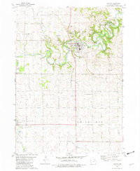
1981 Map of Fayette
USGS Topo · Published 1982About this map
Upper Iowa University anchors the central town of Fayette, where the Volga River winds through the landscape. The geography is defined by the sharp bends of the river and its tributaries, including Frog Hollow and Alexander Creek. This 1981 edition shows the area's transition toward conservation and education, with the Volga River State Recreation Area and a local Picnic Area near the settlement of Albany.
Find a feature on this map
25 named features on this map. Tap any name to fly to it.
Don’t see what you’re looking for? This feature index may not catch every label — zoom into the map to look around manually.
Map Details
Editions of this 1981 Fayette Map
This is the sole edition of this map. No revisions or reprints were ever made.
Other maps of this area

1901 · Oelwein
USGS Topo · 1:125,000

1959 · Dubuque
USGS Topo · 1:250,000

1961 · Dubuque
USGS Topo · 1:250,000

1962 · Dubuque
USGS Topo · 1:250,000

1965 · Elgin
USGS Topo · 1:24,000

1965 · Wadena
USGS Topo · 1:24,000

1965 · Arlington
USGS Topo · 1:24,000

1976 · Dubuque
USGS Topo · 1:250,000
1981 · Stanley
USGS Topo · 1:24,000
1981 · Maynard
USGS Topo · 1:24,000