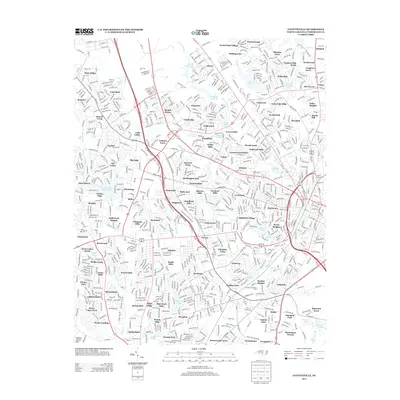
2013 Map of Fayetteville
USGS Topo · Published 2013About this map
Bonnie Doone Lake and Kornbow Lake anchor the residential landscape of northern Fayetteville in this 2013 survey. The area exhibits a dense pattern of mid-to-late 20th-century suburban growth, with distinct neighborhoods like Cottonade and Bizza Ridge organized around a network of primary thoroughfares including the All American Expy and Bragg Blvd. The intricate naming of developments, from Arran Lakes North to Sherwood Park, provides a detailed record of the city's modern expansion and the planned communities that defined its 21st-century footprint.
Find a feature on this map
114 named features on this map. Tap any name to fly to it.
Don’t see what you’re looking for? This feature index may not catch every label — zoom into the map to look around manually.
Map Details
Editions of this 2013 Fayetteville Map
This is the sole edition of this map. No revisions or reprints were ever made.
Other maps of this area

1948 · Fayetteville
USGS Topo · 1:62,500

1948 · Clifdale
USGS Topo · 1:62,500

1948 · Slocomb
USGS Topo · 1:24,000

1948 · Clifdale
USGS Topo · 1:24,000

1949 · Vander
USGS Topo · 1:24,000

1950 · Clifdale
USGS Topo · 1:24,000

1950 · Fayetteville
USGS Topo · 1:24,000

1950 · Manchester
USGS Topo · 1:24,000

1950 · Slocomb
USGS Topo · 1:24,000

1951 · Clifdale
USGS Topo · 1:62,500