
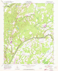
1950 Map of Slocomb
USGS Topo · Published 1950About this map
The Cape Fear River and Little River converge in this mid-century survey of northern Cumberland County, where industrial and agricultural life centered on the local rail lines. Industrial activity is anchored by the Brick Kilns near the settlement of Slocomb, while the Norfolk Southern and Atlantic Coast Line railroads provided the primary conduits for goods and travel through the Carvers Creek and East Over townships.
Find a feature on this map
20 named features on this map. Tap any name to fly to it.
Don’t see what you’re looking for? This feature index may not catch every label — zoom into the map to look around manually.
Map Details
Editions of this 1950 Slocomb Map
2 editions found
Other maps of this area

1948 · Fayetteville
USGS Topo · 1:62,500

1948 · Slocomb
USGS Topo · 1:24,000

1949 · Vander
USGS Topo · 1:24,000

1950 · Fayetteville
USGS Topo · 1:24,000

1950 · Manchester
USGS Topo · 1:24,000

1953 · Raleigh
USGS Topo · 1:250,000

1954 · Raleigh
USGS Topo · 1:250,000

1956 · Anderson Creek
USGS Topo · 1:24,000

1956 · Bunnlevel
USGS Topo · 1:24,000

1957 · Vander
USGS Topo · 1:24,000