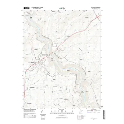
2014 Map of Fayetteville
USGS Topo · Published 2014About this map
New River Gorge National River bisects this landscape, carving a deep canyon through the heart of Fayette County. The map documents the dramatic topography between the high ridges of Hawks Nest and Dogwood Ridge and the whitewater of the New River, where labeled rapids like Fayette Station Rapids and Millers Folly Rapids mark the river's descent. The plateau above the gorge is heavily settled, anchored by the town of Fayetteville and the northern outskirts of Oak Hill. This 2014 survey captures a moment of transition where industrial river history meets modern conservation and recreation.
Find a feature on this map
144 named features on this map. Tap any name to fly to it.
Don’t see what you’re looking for? This feature index may not catch every label — zoom into the map to look around manually.
Map Details
Editions of this 2014 Fayetteville Map
This is the sole edition of this map. No revisions or reprints were ever made.
Other maps of this area

1887 · Hinton
USGS Topo · 1:125,000

1889 · Nicholas
USGS Topo · 1:125,000

1891 · Nicholas
USGS Topo · 1:125,000

1891 · Raleigh
USGS Topo · 1:125,000

1892 · Hinton
USGS Topo · 1:125,000

1897 · Kanawha Falls
USGS Topo · 1:125,000

1897 · Raleigh
USGS Topo · 1:125,000

1900 · Kanawha Falls
USGS Topo · 1:125,000

1901 · Nicholas
USGS Topo · 1:125,000

1901 · Kanawha Falls
USGS Topo · 1:125,000